Mountain in Morocco
Toubkal is the highest mountain in North Africa at 4,167 metres, and the thing that defines it is not the height. It is the drive. Imlil, the village every trek starts from, sits around ninety minutes from Marrakech, so you can eat breakfast in a riad courtyard and be walking uphill before the morning is out. Very few 4,000 metre summits anywhere on earth are that easy to reach, and that accessibility is both the whole appeal of the mountain and the reason a steady stream of people get into trouble on it.
What gets underestimated is that Toubkal is really two mountains sharing one name. From roughly May to October it is a long, steep, relentless walk on rough ground and loose scree, requiring good legs, a head for exposure that never becomes real climbing, and no technical equipment at all. From roughly December to March it is a snow mountain, and the same route becomes an ascent requiring crampons, an ice axe, the ability to self arrest, and an honest read of avalanche conditions in the gullies of the south cirque. The single most dangerous thing about Toubkal is that the winter mountain looks like the summer mountain in photographs, and people book it as though nothing has changed.
The walking itself is straightforward to picture. Imlil sits at about 1,740 metres among walnut and cherry orchards, with irrigation channels running along the terraces and mules standing in the square waiting for loads. The trail climbs the Mizane valley past the stacked stone village of Aroumd, then follows the riverbed on rock and dust to Sidi Chamharouch, a whitewashed shrine built around a boulder where the valley narrows and where drink stalls appear at exactly the moment you want one. Above that it is four more hours of steady, unrelenting uphill to the refuges at around 3,200 metres, sitting in a bowl of stone below the summit slopes. Summit morning starts in the dark and takes three to four hours up the south cirque, an endless gully of loose scree where two steps up buy you one back, before the ground eases onto a broad rocky ridge and a metal frame marks the top.
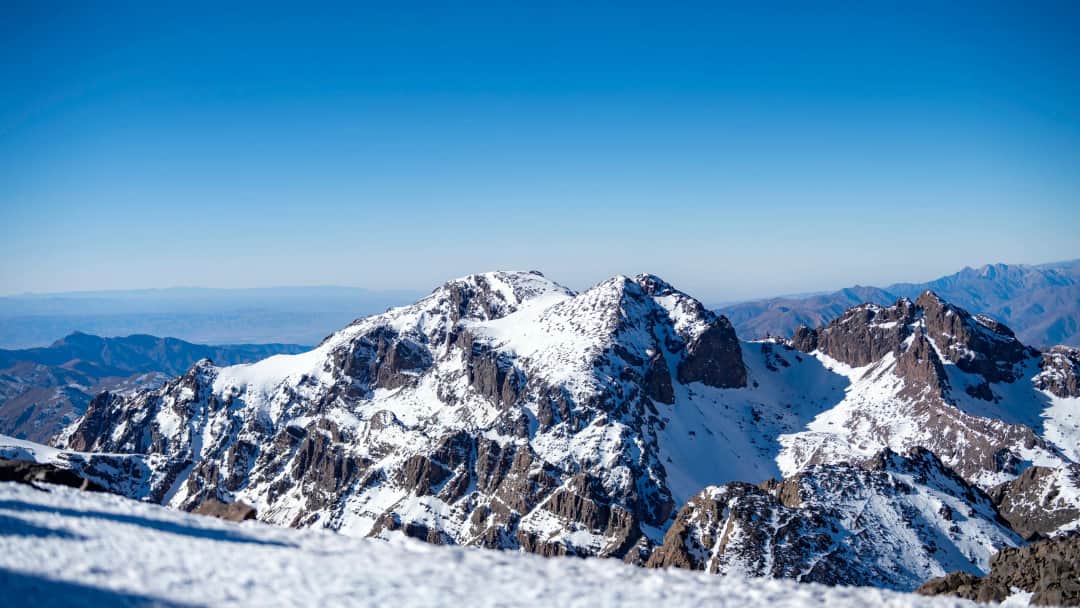
The view from the summit is the reason people put up with the scree. On a clear morning the whole High Atlas runs away in ridges to the east and west, the Anti Atlas beyond that, and to the south the ground drops toward the pre Sahara in a haze the colour of milky tea. It is not a pretty summit. It is a stony, wind scoured, brown and grey place, and it feels much more serious than the drive from Marrakech implies.
The mountain is also a lived in place rather than a wilderness. The valleys below are Amazigh villages farming terraces that have been worked for centuries, and the trekking economy of muleteers, cooks, guides and refuge staff is one of the main sources of income in the Mizane and Azzaden valleys. The September 2023 earthquake in Al Haouz province hit this exact area hard, damaging villages around Imlil, Asni and the roads that serve them. Trekking has resumed and visitor income matters here more than ever, but you will pass rebuilding as you walk, and it is worth arriving with some awareness of that rather than treating the valley as scenery.
Best time to visit
April to early June and September to early November are the best weeks of the year on Toubkal, and if your dates are flexible those are the ones to take. In those windows the summit is usually clear of significant snow or holds only patches you can walk around, daytime temperatures in the valley are pleasant rather than punishing, and the air on summit morning is cold enough to want gloves without being hostile. Late spring has the added advantage of meltwater still running in the Mizane and green terraces below Aroumd, while October gives you the most stable, cloudless mornings of the year.
July and August work perfectly well on the mountain itself, and this is when a large share of trekkers actually go, but the heat lower down is the problem. Marrakech can sit above forty degrees and the walk from Imlil to Sidi Chamharouch is exposed and shadeless for most of its length, so groups start early, drink far more than they planned, and arrive at the refuge already flattened. Afternoon build up and occasional thunderstorms are common in high summer, which is another argument for the pre dawn start on summit day rather than a lie in. The refuges are at their busiest in these months.
December to March is winter and should be treated as a separate undertaking. Snow lies on the upper mountain and often down to the refuge and below, the scree of the south cirque becomes a snow slope, and both crampons and an ice axe are needed along with the practised ability to use them. Avalanche risk in the cirque gullies is real after heavy snowfall and has killed people. A winter ascent with an experienced guide, the right kit and a willingness to turn back is a superb mountain day and much quieter than summer. A winter ascent booked as though it were a summer walk is the classic way this mountain hurts people.
November and March are the genuinely unpredictable months, and this is where trips go wrong through no fault of the operator. You may find dry rock and shirtsleeve walking, or you may find fresh snow above the refuge and a summit that needs equipment nobody in the group is carrying. If you are travelling in those shoulder weeks, ask your operator directly what happens if there is snow, and confirm that crampons and axes can be provided rather than assuming the question has been handled.
High season
July and August are the busiest, driven by European summer holidays and by Moroccan visitors escaping the heat, and the refuges below the summit are full most nights with people sharing dormitories and eating in shifts. Easter and the weeks either side are a second peak. Winter weekends draw a smaller but committed crowd of climbers and ski tourers. Late September, early October and mid week days in May are the sweet spot for a quieter mountain in good conditions.
Toubkal is not a wildlife trek and nobody should book it expecting one, but the mountain runs through three quite distinct zones in a single day of walking, and the change is one of the pleasures of the ascent. The valley floor around Imlil and Aroumd is an irrigated garden: walnut trees, cherry and apple orchards, poplars planted for building timber, and terraces of maize and barley fed by seguias, hand cut channels that carry water along the contour for kilometres. It is startlingly green against bare brown mountainsides, and it exists entirely because of that water management.
Above the last villages the greenery stops almost abruptly. The middle ground is juniper, thorny scrub and low cushion plants that grow flat and hard against the rock to survive wind and grazing, with goats and sheep working ground that looks incapable of feeding anything. Higher still, above the refuges, there is essentially nothing but scree, boulder and snow patch. The rock here is volcanic in origin, dark andesite and rhyolite, which is why the summit slopes are made of endless small loose plates rather than the sandy gravel people expect.
For animals, keep your expectations modest and your eyes up. Alpine choughs, glossy black with red legs, patrol the refuges and the summit ridge and will investigate an unattended lunch with real confidence. Ravens work the same ground. Golden eagles hunt the cirques and are seen often enough that a guide will point one out without ceremony. Smaller birds are the reward for the observant: Moussier's redstart, a bright little bird found only in northwest Africa, crimson winged finch on the high stony ground, and black wheatears on the rocks lower down. Barbary ground squirrels live among the boulders near the villages and around Sidi Chamharouch, striped and quick and quite used to people.
Larger mammals are scarce and mostly nocturnal, and honest guides will tell you so. Barbary sheep survive in small numbers in the wider massif but a sighting on the standard route would be exceptional. What you are more likely to notice is the human landscape and the mules, which are the working engine of the whole valley: they carry gas bottles, cement, food and trekking bags up to the refuges and are as much a part of the mountain as the rock. Above the refuge they cannot go, which is why summit day is the only part of the trek where you carry everything yourself.
The standard two day ascent from Imlil
This is what most operators sell and what most people walk. Day one leaves Imlil in the late morning and climbs the Mizane valley through Aroumd and Sidi Chamharouch to the refuges at around 3,200 metres, roughly five to six hours with a total gain of about 1,500 metres, with mules carrying the bags so you walk with a daypack. You eat early, sleep badly in a cold dormitory, and leave at four or five in the morning for the summit, three to four hours up the loose scree of the south cirque, then back down to the refuge for breakfast and all the way out to Imlil the same day. It works, thousands of people do it every year, and the whole thing fits into a two night gap in a Marrakech holiday. The honest drawback is that it takes you from 1,740 metres to 4,167 metres in under twenty four hours of walking, which is a lot of altitude very quickly, and it is the main reason people either fail on summit morning or reach the top feeling genuinely awful.
The three day ascent with an acclimatisation day
The same route with an extra night, and for most people it is the better trip by a wide margin. You either walk to the refuge on day one and spend day two on a shorter high walk, for example up towards Tizi n'Ouanoums or partway up a neighbouring slope, sleeping a second night at 3,200 metres before summiting on day three, or you break the approach with a night in Aroumd or a higher village first. Either way you give your body a night to adjust before asking it to work hard above 4,000 metres. If you can spare one more day, spend it here rather than anywhere else in your Morocco itinerary, because it is the difference between enjoying summit morning and enduring it. The extra day also builds in a weather buffer, which matters more than people expect in spring and autumn when a single bad morning can otherwise end the whole attempt.
The winter ascent
From roughly December through March the route is the same on a map and completely different underfoot. The scree of the south cirque becomes a snow slope of forty degrees or more in places, the traverse onto the summit ridge is exposed, and a slip without an ice axe has nowhere good to stop. You need crampons that actually fit your boots, stiff enough boots to take them, an ice axe and the skill to self arrest, plus proper insulation for a summit temperature that can sit well below freezing with wind on top of that. Avalanche risk after fresh snow is real and the gullies here have killed climbers. In exchange you get a mountain that is quiet, clean and far more dramatic than its dusty summer self, with the whole Atlas under snow. Book winter with an operator who guides winter routinely, ask what equipment is included, and accept in advance that turning around short of the top is an ordinary outcome rather than a failure.
The north cirque as a variant
Most parties go up and down the south cirque because it is the shortest line from the refuge to the summit. The north cirque, Ikhibi Nord, is the alternative: longer, less trodden, and a more interesting piece of mountain with better structure than the endless scree chute on the south side. Some guides use it as a descent to make a loop out of summit day, which spreads the traffic and gives you fresh ground on the way back rather than sliding down the same gully you laboured up. It is a slightly more committing line and it holds snow later into the season, so it is a decision for your guide on the morning based on conditions rather than something to insist on when you book. If the weather is settled and your group is moving well, ask whether the loop is possible.
Ouanoukrim, Timesguida and the other high summits
Toubkal is not the only 4,000 metre peak in this cirque, and the refuges are a base for several. Timesguida n'Ouanoukrim, the second highest summit in Morocco, and its neighbour Ras n'Ouanoukrim are both reached from the same refuges by a different valley, taking a comparable amount of effort on a much quieter mountain. Afella and Biguinoussene sit on the same ridge system. Adding one of these to a Toubkal trip turns a summit dash into a proper mountain few days: you sleep two or three nights at the refuge, walk a second big peak, and get the same views without a queue at the top. For anyone who has already climbed Toubkal, or who wants an ascent that feels less like a conveyor belt, this is the most rewarding thing to do in the massif.
The Azzaden valley approach via Tizi Mzik
Instead of walking straight up the Mizane, you can cross west out of Imlil over the Tizi Mzik pass and drop into the Azzaden valley, sleep at a refuge or a village gite there, then work back over Tizi n'Tacheddirt or around to the Toubkal refuge on the second day. It is a longer approach and it adds at least a day, but it does three useful things: it puts a proper acclimatisation night at altitude into the plan, it takes you through terraced villages that see a fraction of the foot traffic of the main trail, and it opens access to Tazaghart, a broad plateau summit with a completely different character to Toubkal. This is the route to choose if the walking itself matters to you as much as the summit, and it is the one most repeat visitors end up recommending.
The Toubkal circuit over five to seven days
The full circuit walks around the massif rather than straight at it, and it is a serious and satisfying trek in its own right. A typical line goes from Imlil over Tizi n'Tacheddirt, on through high pastures and shepherd shelters at Azib Likemt, down to Lac d'Ifni, the only real lake in the range and a startling blue thing sitting in a bowl of grey rock, then up the long climb to Tizi n'Ouanoums at around 3,660 metres and down to the Toubkal refuge, with the summit taken on the following morning when you are properly acclimatised. Nights are in village gites and mountain refuges, mules carry the loads, and you pass through country where the walking day, not the summit, is the point. Anyone with a week and reasonable fitness gets far more out of this than out of a two day summit sprint.
The southern approach from Amsouzert
Coming at Toubkal from the south, starting at Amsouzert on the far side of the range, is the quiet option. The valley is greener and lower, the villages are less used to trekkers, and you approach through Lac d'Ifni and over Tizi n'Ouanoums rather than up the crowded Mizane. It takes longer to reach the trailhead by road from Marrakech, usually via Ouarzazate or over the Tizi n'Test, which is exactly why so few groups do it. The natural version is a traverse: start in the south, summit from the refuge, and walk out north to Imlil, so you cross the whole massif and finish an easy drive from Marrakech. Ask your operator specifically about this, because it is rarely on a standard itinerary list and usually has to be requested.
Mountain
Mount Toubkal
Take it with you
Everything on this page in one document you can keep, print, or send to whoever you are travelling with. No email required.
In summer conditions there is no climbing on the standard route. It is a walk, but a long and steep one on rough ground, and the difficulty is aerobic and mental rather than technical. Expect around 1,500 metres of ascent on day one over five or six hours, then a further 950 metres or so on summit morning over three to four hours on loose scree where the footing constantly slides. If you can walk uphill for six hours with a daypack and are willing to keep going when it stops being fun, you can do it. In winter the answer changes completely: crampons, an ice axe and the ability to use them are not optional, and the route is a mountaineering objective rather than a hike.
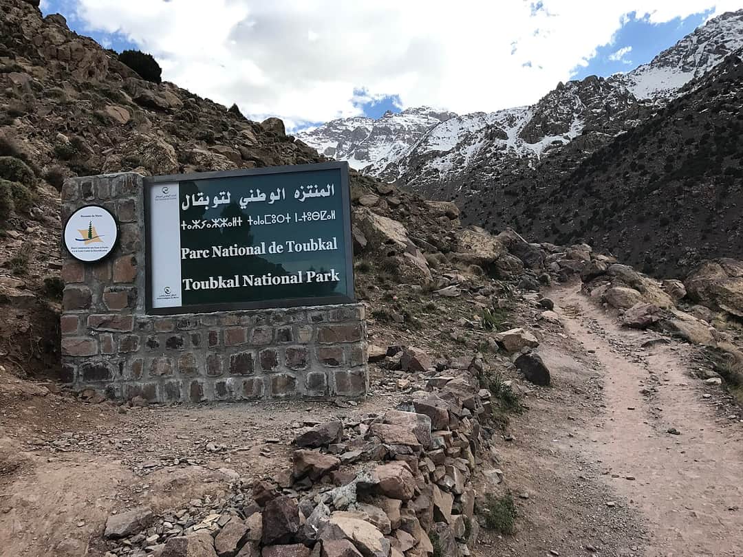
Yes, and you should plan on it regardless of what you read in older forum posts. Morocco requires trekkers in Toubkal National Park to be accompanied by an accredited mountain guide, and this is checked at the Imlil trailhead. Beyond the rule, a guide is genuinely useful here: they read the snow line and the weather, they set a pace that keeps people together on summit morning, they arrange the mules and the refuge beds, and they will tell you honestly when someone in the group should turn round. Book through an operator who uses accredited guides rather than arranging something informally in the village square, and confirm before you travel whether mules, refuge nights and meals are included in what you are paying.
Three days, if you can spare it. The two day version is popular because it fits a short holiday, but it takes you from 1,740 metres to over 4,100 metres in roughly a day and a half of walking with effectively no acclimatisation, and that is why a meaningful share of people on any given summit morning feel sick, dizzy or exhausted, and why some turn back within sight of the top. The third day, spent sleeping a second night high or walking a shorter high route before the summit push, transforms the odds and the enjoyment. It also gives you a spare morning if the weather closes in, which in spring and autumn is worth having on its own.
4,167 metres is high enough to affect most people and high enough to be dangerous if ignored. Headache, poor appetite, broken sleep at the refuge and breathlessness on the scree are all normal and usually manageable. What is not normal, and what means you go down immediately rather than pushing on, is worsening headache that does not respond to rest, repeated vomiting, confusion, loss of coordination or breathlessness at rest. Drink far more than feels necessary, walk the summit slope more slowly than your ego suggests, and tell your guide honestly how you feel rather than hiding it until the top. Going down even a few hundred metres relieves symptoms quickly, which is one of the advantages of a mountain where the refuge is only a few hours below the summit.
There are two next to each other at around 3,200 metres, the older Refuge du Toubkal and Refuge Les Mouflons, and both are functional mountain huts rather than accommodation in any hotel sense. Expect shared dormitories with bunks and mattresses, blankets available but a sleeping bag or liner recommended, communal meals of soup, tagine and bread cooked by the staff, limited and unreliable electricity, and cold nights that catch people out even in summer. Washing facilities are basic and hot water is not something to count on. In July and August they fill, so beds are allocated by your operator in advance rather than on arrival. Bring earplugs, a head torch and warm layers to sleep in, and accept that nobody sleeps well the night before summit day.
For a summer ascent: broken in boots with ankle support, since the scree is punishing in trainers, a warm layer and a windproof jacket for the summit even in August, hat and gloves, sun protection that is far stronger than you think because the high sun here is savage, at least two to three litres of water capacity, a head torch for the pre dawn start, and a sleeping bag liner or light bag for the refuge. Trekking poles make an enormous difference on the scree descent and are worth carrying even if you never normally use them. For winter add crampons, an ice axe, stiff boots that take crampons, proper insulated layers and gaiters, and check whether your operator supplies the technical items or expects you to arrive with them.
May and October are the two strongest months, with April, early June and September close behind. Those weeks usually give you a snow free or nearly snow free summit route, stable mornings, and comfortable temperatures on the approach. July and August are perfectly climbable but the valley heat makes the walk in hard work and the refuges are at their fullest. December to March is snow season and a different undertaking requiring winter equipment and skills. November and March are the coin toss months when you may find either mountain, so ask your operator in advance what the plan is if there is snow on the upper slopes.
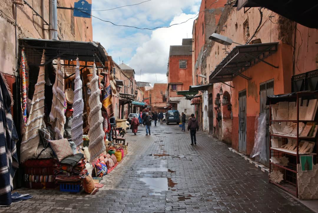
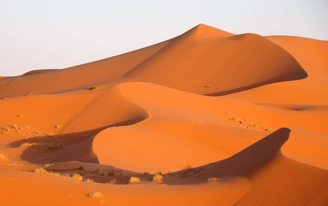
Easily, and most people should. The trek starts and ends within two hours of Marrakech, so a three day Toubkal trip drops neatly into a longer trip with days in the medina either side. Doing the mountain first and the city afterwards is the more comfortable order, since the medina is a lot more enjoyable when you are not walking on ruined legs at four in the morning. Longer combinations work well too: Toubkal followed by Essaouira on the coast for wind and seafood, or Toubkal followed by the long drive out to the Sahara at Merzouga. If you are pairing the mountain with the desert, do the mountain first while you are fresh, because two days in a vehicle is much easier to absorb after a trek than before one.
Fitness matters more than age here, but altitude is the great equaliser and it does not care how many gym sessions anyone has done. Fit teenagers manage the trek regularly, and so do walkers well into their sixties and seventies who hike often at home. The right adjustment for both groups is the same: take the three day version, walk slowly, and treat the summit as optional rather than as the purpose of the holiday. Younger children are a harder call, since the approach is long and exposed and the refuge is cold and communal, and a shorter valley trek from Imlil to Aroumd, Sidi Chamharouch or over into the Azzaden gives families the same landscape without asking a small body to handle 4,000 metres.