Site in Zimbabwe
You hear it before you see it. On the walk up from the entrance gate there is a low continuous roar coming through the trees, and then rain falling out of a blue sky, and only then the water itself. The local name, Mosi-oa-Tunya, the smoke that thunders, is a plain description rather than poetry. In April the column of spray stands several hundred metres above the bush and is visible from the aircraft long before the town appears underneath it, and the ground beside the path genuinely shakes.
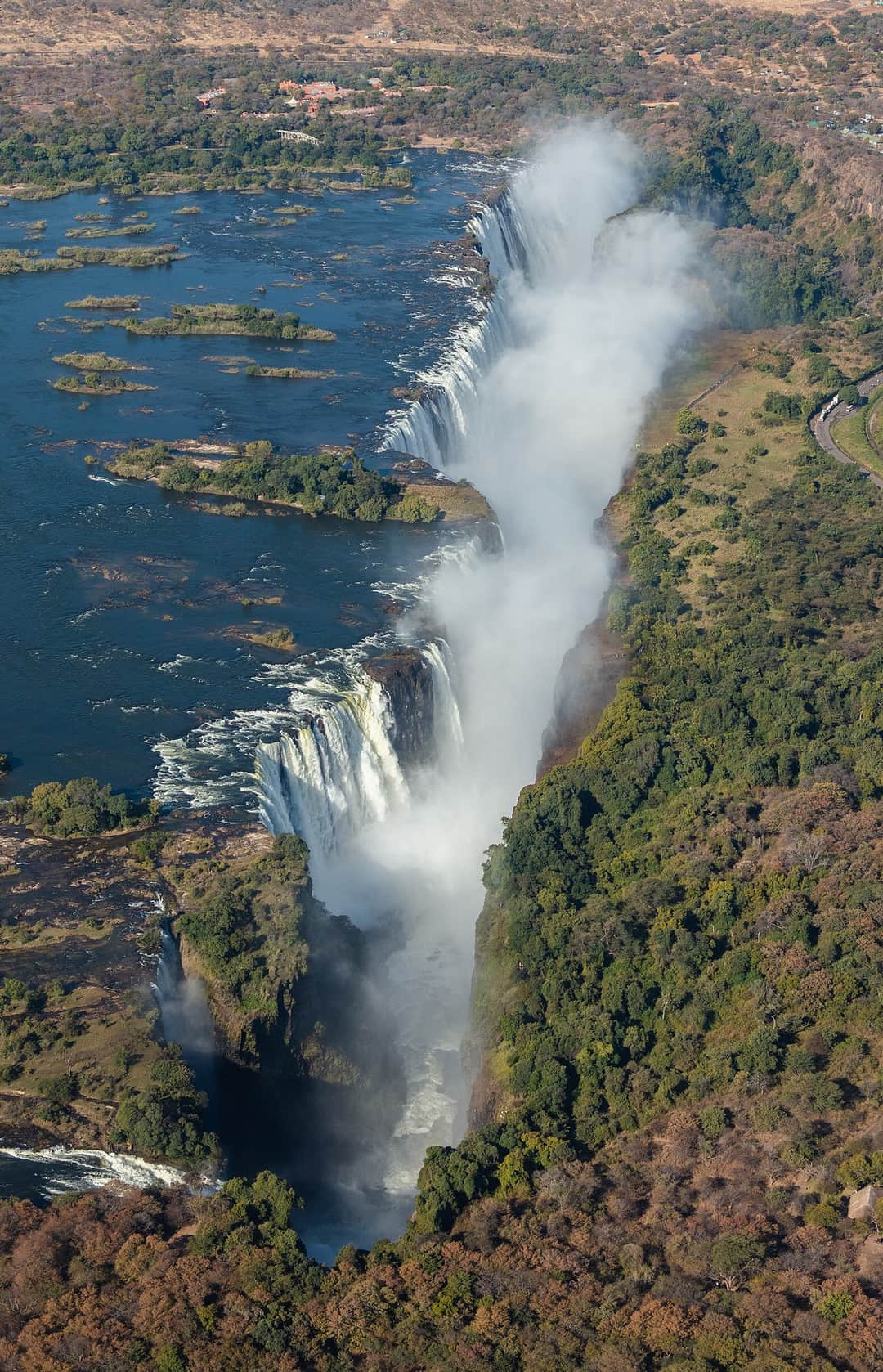
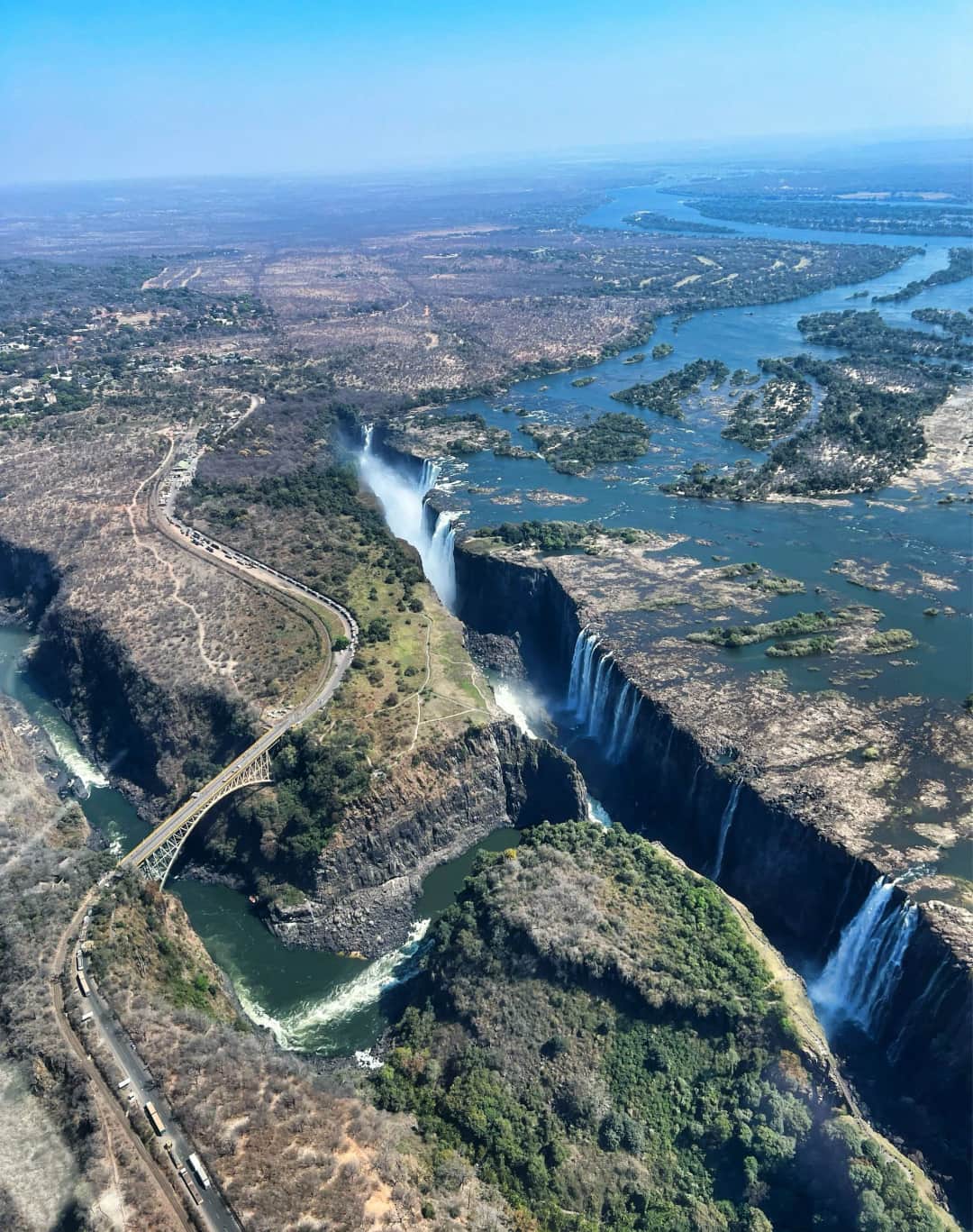
What makes this waterfall unlike other famous ones is its shape. The Zambezi runs wide, flat and unhurried across a sheet of basalt, then drops into a narrow crack that sits at right angles to its course, roughly 1,700 metres long and over 100 metres deep, with only one gap at the eastern end for all that water to escape through. Because the opposite wall of the crack stands barely a hundred metres away, you do not peer down at this waterfall from above or crane up at it from a plunge pool. You stand on a cliff facing it, level with the lip, close enough that the spray arrives sideways. Almost the entire Zimbabwean experience is this head-on, eye-level view, and very few waterfalls anywhere offer it.
The border runs down the middle of the gorge and the falls are shared with Zambia, which is where most trip planning starts to wobble. The Zimbabwean bank holds the great majority of the falls frontage, including Devil's Cataract, Main Falls and Horseshoe, so this is the side that shows you the waterfall as one continuous object rather than in fragments. It is also the side that keeps a serious curtain of water in the dry months, when the eastern end over in Zambia can thin out badly. If you are only going to stand on one bank, this is the one that will not disappoint you in any month of the year.
The viewing itself is a walk, not a lookout. A path runs for a little over a kilometre through genuine rainforest, an ecosystem that exists here only because falling spray waters it every day of the year, with sixteen numbered viewpoints stepping east along the cliff from the statue of Livingstone above Devil's Cataract to Danger Point at the far end. Allow two hours if you intend to actually look. Most people budget forty minutes, then find themselves standing at the same railing for a quarter of an hour watching a rainbow move.
The other thing this side gives you is a base you can walk out of. Victoria Falls town sits about a kilometre from the entrance, small enough to cross on foot in twenty minutes, and built around visitors to a degree that is either convenient or slightly artificial depending on your mood. Warthogs graze the verges and the hotel lawns with total indifference to traffic. Baboons work the bins and will take food out of your hand if you are careless with it. Elephant occasionally cross the road out towards the airport. That, plus the fact that the bungee, the rafting, the cruises and the helicopters all leave from within a few minutes of your room, is why a great many people who intend to stay two nights end up staying four.
Best time to visit
Everything at Victoria Falls turns on how much water is coming over, and the Zambezi's flood is not aligned with the rain you experience on the ground. The catchment sits far upstream, so the river keeps rising for weeks after the local rains have stopped. Flow builds from January, peaks around April, and falls away steadily through the second half of the year to a low point around late October and November.
High water, roughly February to May and at its most extreme in April, is the falls at maximum volume and, counter-intuitively, the hardest time to actually see them. The spray becomes a permanent vertical weather system that boils up out of the gorge and falls back onto the path, and there are days at the peak when the eastern viewpoints and Danger Point show you nothing but white. You will be soaked through within minutes regardless of what you are wearing. The compensation is the sound, the sheer scale of the thing, and rainbows in the spray for most of the day. Come in April if you want to be overwhelmed. Do not come in April expecting the photograph on the poster.
June to August is the sensible answer for a first visit and the reason this is peak season. There is still a great deal of water going over, the spray has dropped enough that the western and central viewpoints are clear and the whole width can be seen at once, and the weather is dry, mild and bright. Mornings in June and July can be genuinely cold at dawn, which surprises people who packed only for Africa. This is the window where the falls look most like the image in your head.
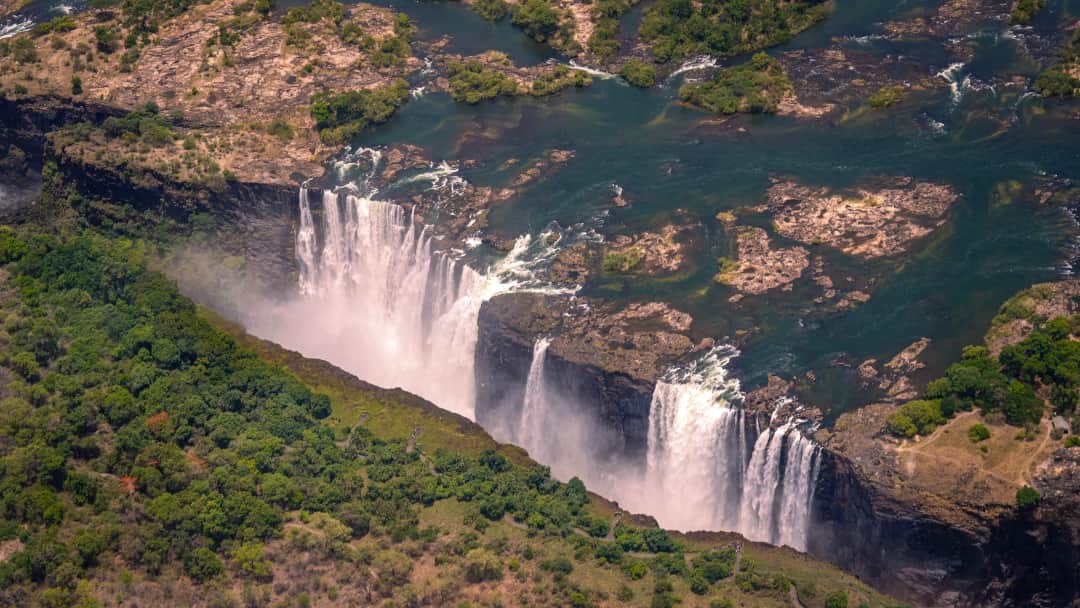
September to December is low water and it is a different trip rather than a lesser one. The spray thins, the basalt lip emerges, and you can finally read the geology: the ledge, the notches, the way the river has cut backwards through the rock over time. Devil's Cataract and Main Falls on the Zimbabwean side hold a strong flow even at the bottom of the cycle, which is exactly why this bank is the safer choice for a low water visit. This is also when the Batoka Gorge opens up for the full rafting run and when the swimming at the lip becomes possible over on the Zambian side. The cost is heat. October is punishing, regularly over forty degrees, and the bush is grey and leafless. January and February bring the first storms, humidity, green, and a rising river.
If you want one rule: come in June or July for the view, in April for the power, and in September or October if the river below the falls interests you more than the falls themselves.
High season
July and August are the busiest months, followed by the stretch from mid-December into early January and the Easter weekend, when southern African families arrive in numbers. In peak weeks the rainforest path is steadily busy from mid-morning until late afternoon and the better hotels book out months ahead. Go through the gate at opening time and you will have the western viewpoints close to yourself for the first hour. February and November are the quietest months in town.
The headline organism here is the rainforest itself. The strip of forest along the cliff opposite the falls survives on spray alone, in a region that is otherwise dry woodland, and it holds ebony, mahogany, wild date palm, strangler figs and a permanently dripping understorey that has no business existing in this landscape. Walk fifty metres away from the cliff edge and it stops abruptly and turns back into ordinary Zambezi teak and mopane bush. That hard boundary is one of the more interesting things on the path and almost nobody notices it.
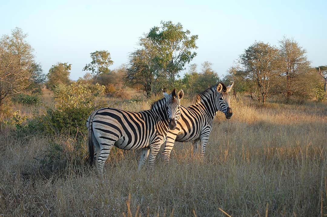
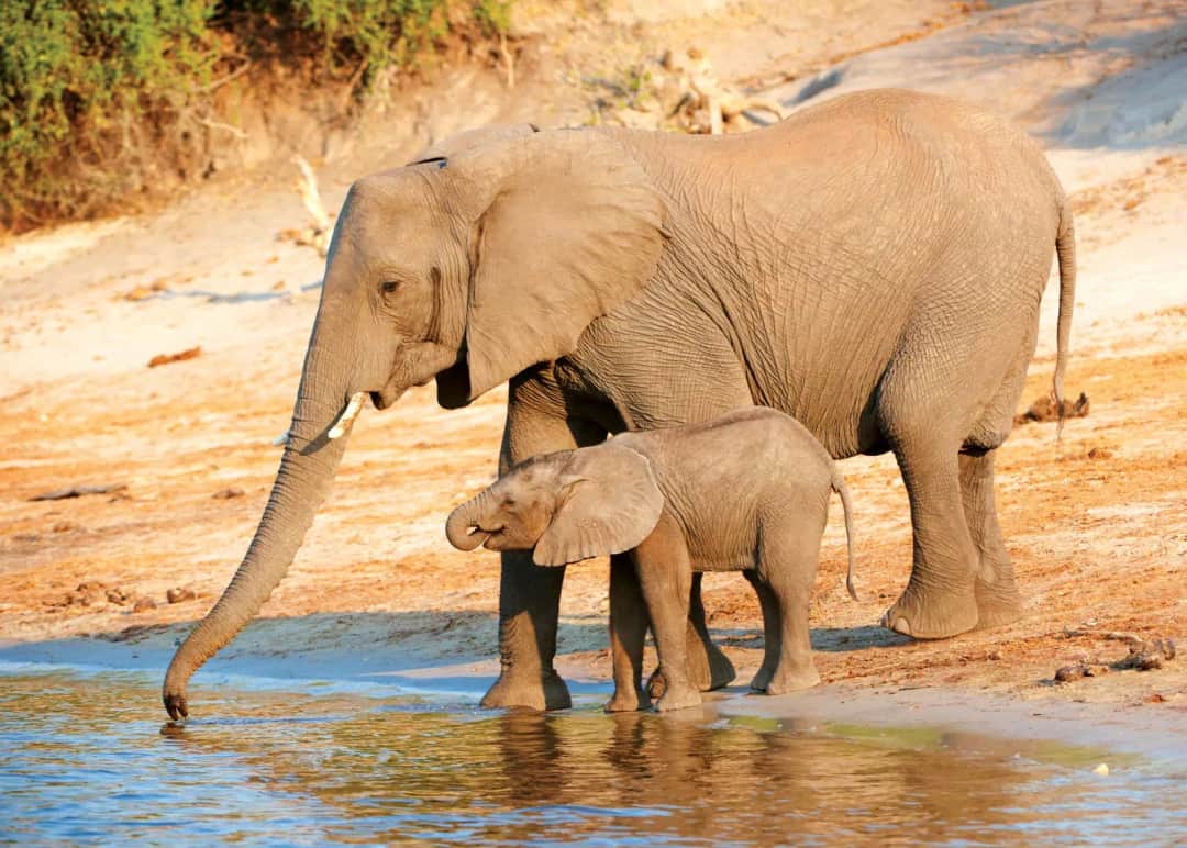
Inside the rainforest and in the town itself you meet the resident animals constantly. Warthog families graze the verges, roundabouts and hotel lawns and trot off with their tails up when a car passes, entirely habituated. Chacma baboons and vervet monkeys are the actual nuisance: they work the bins, the car parks and the restaurant terraces, and they will open an unattended bag. Keep food out of sight, close windows in your room and do not attempt to feed them. Bushbuck slip through the forest along the path, banded mongoose run in packs across the lawns, and elephant sometimes wander through the outskirts of town and along the road towards the airport at night.
Proper game viewing is a short drive upriver. Zambezi National Park runs along the southern bank above the falls and holds elephant, buffalo, giraffe, zebra, waterbuck, kudu, sable and eland, with lion and leopard present but not commonly seen. It is a quiet, uncrowded park with river frontage that most visitors ignore entirely in favour of the adrenaline menu, which is a shame, and a morning drive there is the cheapest way to add a genuine safari morning to a falls trip.
Birding is unusually good for such a small area. The gorges below the falls hold Verreaux's eagle and are one of the more reliable places on the continent to look for the Taita falcon, a small and very localised raptor that draws birders here specifically. Trumpeter hornbills call over the rainforest, Schalow's turaco moves through the canopy, and at low water rock pratincoles appear on the exposed rocks in the river above the lip. Along the river you get African skimmers, fish eagles on almost every dead tree, and half-collared kingfishers in the quieter channels.
The rainforest path and the sixteen viewpoints
This is the reason to come and it deserves more time than most itineraries give it. The path leaves the entrance and runs east along the cliff for a little over a kilometre, with sixteen numbered viewpoints, each of which shows a different section: Devil's Cataract first, then Main Falls at its widest, then Horseshoe and Rainbow Falls. The character of the walk changes completely with the season. In high water it is a rain forest in the literal sense, with water falling on you from a clear sky and a permanent white roar; in low water it is a dry, shaded stroll with the entire rock face laid bare in front of you. Go at opening time for the light and the quiet, walk the whole thing once without stopping to work out where the good angles are, then walk it back slowly. Wear shoes with grip because the paved sections turn slick, and accept that in the wet months your camera will need a bag rather than a cloth.
Devil's Cataract and the statue of Livingstone
The western end of the path is where the falls started, geologically speaking, and where they are heading next. Devil's Cataract is a deep notch cut lower than the rest of the lip, which is why it keeps a thundering flow even in November when other sections have quietened to streaks. A short flight of steps, the Chain Walk, drops you down towards the level of the water for a view up into the notch that is one of the best on either bank and skipped by a surprising number of visitors. Just above it stands the bronze of David Livingstone, who reached this point in 1855 and named the falls for his queen, though the name the region actually uses remains Mosi-oa-Tunya. The statue is the standard photograph and the surrounding area is the calmest part of the whole walk, worth ten minutes in the shade before you head east into the spray.
Danger Point and the far eastern viewpoints
Past the end of the paved section the path turns rougher and runs out onto a bare basalt promontory with no railing at the tip. Danger Point is named honestly: the rock is wet, sloping and slippery, the drop is over a hundred metres, and people have died being careless there. From it you look straight across at the Eastern Cataract on the Zambian side, down into the Boiling Pot where the river turns through ninety degrees, and along the gorge to the bridge. In high water it is often a whiteout and you will see nothing but feel a great deal; in the dry months it gives you the best single understanding of how this whole system fits together. A short branch path leads to a separate viewpoint over the bridge itself, which is where the classic photograph of the arch with a train on it is taken.
The Victoria Falls Bridge, the bungee and the gorge
The bridge went up in 1905, part of Cecil Rhodes' Cape to Cairo railway ambition, and he specified that it be built where the spray from the falls would fall on passing trains. It still carries road, rail and foot traffic across the gorge between the two countries, and you can walk out onto it from the Zimbabwean side without formally entering Zambia, though you do pass through border control to do it. From the middle you get a view down the Batoka Gorge that no viewpoint on either bank gives you. The commercial jumps operate from the same span: a bungee of around a hundred and eleven metres straight down towards the Zambezi, plus a gorge swing and a zip line across. If heights are not your business, the guided bridge tour walks you underneath the deck on the maintenance catwalk and through the engineering history, and is considerably more interesting than it sounds.
Sunset cruise on the upper Zambezi
Above the falls the river is a completely different creature: wide, slow, split around wooded islands, with no hint of what happens a few kilometres downstream. The sunset cruise is the most booked activity in town and the reason is simply that it works. Boats leave in the late afternoon from jetties a short drive upriver, drift among the islands for two to three hours, and put the sun down behind the water at the end. You will see hippo in numbers, crocodile on the sandbanks, elephant coming down to drink or swimming between islands in the right season, and fish eagles calling. The trade-off is the format. The large boats are noisy, packed and heavily focused on the open bar; the smaller ones cost more and are far better for photographs and for actually hearing the birds. Pay the difference if you can.
White water rafting in the Batoka Gorge
Below the falls the Zambezi runs through a black basalt gorge in a sequence of numbered rapids, several of them grade five, and it is regarded as one of the great commercial one day white water runs in the world. The season matters more than anything else. From roughly August to December, when the river is low, the full high water rapids are runnable and you get the long classic run; during the flood months the flow is too heavy and only a shortened section operates, or nothing at all. Be clear about the physical commitment: you walk down into the gorge at the start and, more to the point, you climb back out at the end, several hundred steep steps in the afternoon heat, and that climb defeats more people than the rapids do. Flips are normal rather than a failure, and everyone runs with safety kayakers alongside.
Helicopter flights over the falls
The Flight of Angels is a short helicopter loop, typically twelve to fifteen minutes for the standard version and around twice that if you take the extension over Zambezi National Park and the gorges. It is the only way to grasp the geometry of the place: the flat river, the sudden zigzag crack, the gorges below spelling out where the falls used to be as they cut backwards through the basalt over the ages. Sit on the left side for the first pass if you can, though the pilots circle both ways so everyone gets the shot. It is expensive relative to the rest of the day and it is over quickly. In high water it is arguably the single best purchase of the trip, because from the air the spray reveals the falls rather than hiding them. In very low water the aerial view is more geological than dramatic and the ground viewpoints are already doing the job.
Zambezi National Park, the town, and Chobe in a day
Victoria Falls is an unusually easy place to fill spare time. Zambezi National Park begins a few minutes upriver and offers morning game drives along the river loop for elephant, buffalo, sable and giraffe with almost no other vehicles about. In town the Big Tree, an enormous baobab, is a five minute stop, and afternoon tea on the terrace of the old railway hotel with the bridge in the middle distance is a genuinely pleasant hour. Craft markets are extensive and the selling is persistent, so decide your price before you engage. For a bigger day out, Chobe in Botswana is around an hour and a quarter each way by road, and a day trip combining a morning game drive with a boat cruise on the Chobe river delivers the best elephant viewing in the region. It makes for a long day, but it is the strongest add-on available from this side.
Site
Victoria Falls
Take it with you
Everything on this page in one document you can keep, print, or send to whoever you are travelling with. No email required.
If you can only stand on one bank, stand on this one. Zimbabwe holds the great majority of the falls frontage and gives you the head-on panoramas, so this is the side that shows the waterfall whole, and it keeps real water going over even in the driest months when the Zambian eastern cataract can slow to almost nothing. What Zimbabwe cannot give you is proximity. Zambia puts you far closer to the water at the Knife Edge Bridge, and it holds the only access to Livingstone Island and the Devil's Pool, which are seasonal and exclusive to that bank. The honest answer for anyone with more than two nights is to base yourself in Victoria Falls town and cross for a day, rather than choosing.
Yes, and a large number of visitors do exactly that. The two entrances are only a few kilometres apart with the bridge between them, and the crossing is a short taxi ride or a walk if you are willing. You go through Zimbabwean exit formalities, cross the bridge, and clear Zambian entry on the far side, and the whole thing is a routine matter of paperwork and queueing rather than an expedition. Border arrangements and entry requirements change, so check the current position with your operator or hotel before the day rather than relying on anything written in advance. If your target is the Devil's Pool, book the island trip well ahead, because slots are limited and sell out in the season.
The Zambezi peaks around April, having risen since January, because the catchment that feeds it sits far upstream and drains long after local rain has stopped. It falls away through the second half of the year to a minimum around late October and November. More water is not automatically better. At peak flood the spray is so heavy that the eastern half of the path can be a complete whiteout, cameras are close to unusable, and you experience the falls as noise, wind and water rather than as a view. In low water you can see the whole rock face, read the geology and take clear photographs, but the eastern sections thin out. June and July sit in the middle and are the safest choice for a single visit.
Between roughly February and June, extremely wet. Not damp, but as wet as standing in a heavy shower for an hour, with water coming upwards and sideways as well as down. Ponchos are available to rent at the entrance and they help, though they do not keep you dry so much as keep the worst off. Sandals or shoes you do not mind soaking are better than trainers that will stay wet all day, and a dry bag or at minimum a sealed plastic bag for your phone and camera is not optional in those months. From September to December you will barely need any of it and a hat and water matter more than waterproofs. Whatever the month, footwear with grip is worth having, because the wet paving and the bare rock at Danger Point are slippery.
Two nights is the common booking and it is enough to see the falls properly and do one big activity. Three nights is the number that actually suits the place: one morning on the rainforest path, one day for the Zambian side or for rafting, one afternoon on the river, and enough slack that a cancelled helicopter flight or a rained-out morning does not cost you the trip. Four nights is not excessive if you intend to add Chobe or a morning in Zambezi National Park. Anyone arriving off a safari circuit and treating this as a stopover usually regrets giving it one night, because the activity menu here is deep and everything competes for the same short daylight hours.
On this bank, yes, without much hesitation. Devil's Cataract and Main Falls carry a strong flow year round, so you will see a serious waterfall in any month, and low water gives you things the flood cannot: the entire rock face visible, clear photography, no need for waterproofs, and the geology of the gorge laid out in front of you. It is also the season that unlocks the full rafting run through the Batoka Gorge and the swimming at the lip over on the Zambian side. The caveat is that if you cross to Zambia in October or November you may find the Eastern Cataract reduced to a trickle over bare rock, so set expectations for that half of the day accordingly.
No. The Devil's Pool sits on the lip of the falls next to Livingstone Island, and the island is reached by boat from the Zambian bank only. There is no route to it from Zimbabwe and no operator on this side can put you in it directly, though plenty will sell you the crossing and the booking as a package. It also runs only in low water, roughly from the middle of August into January depending on the year's flow, because at any higher level the current over the lip is lethal. If the pool is the reason you are coming, plan your dates around the water level first and everything else second, and book the island slot early.
The town is one of the more relaxed places in the region for visitors and walking between hotels, restaurants and the entrance gate in daylight is normal. The usual sense applies after dark, when a taxi is the better call, partly for ordinary reasons and partly because elephant and buffalo do move through the edges of town at night. The animals you will meet by day are warthogs, which ignore you, and baboons and vervet monkeys, which do not. Do not carry visible food, do not leave a bag on a table, and keep hotel windows and balcony doors closed. Baboons are strong and occasionally aggressive and feeding them is what created the problem in the first place.
Victoria Falls Airport sits about twenty kilometres from town and generally carries the wider choice of regional connections, including links through Johannesburg, Nairobi, Addis Ababa and domestic hops from Harare, which is the main practical argument for basing yourself on this side. Livingstone's airport in Zambia serves the same waterfall from the other bank with a thinner schedule. Transfers into town take around half an hour and every hotel arranges them. Overland, Victoria Falls connects by road to Hwange National Park in a few hours and to Kasane in Botswana in a little over an hour, which is why so many southern African itineraries treat it as the pivot point between a safari and a beach or city leg.