Mountain in Kenya
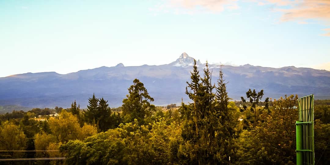
The first thing to get straight about Mount Kenya is that it has three summits and they are not the same undertaking. Batian at 5,199 metres is the true top and Nelion, 5,188 metres, stands beside it across a notch called the Gate of the Mists. Both are rock peaks and both require ropes, harnesses, a competent lead climber and a real day of technical climbing at altitude. Point Lenana, 4,985 metres, is the third summit, and it is a walk. Trekkers climb Point Lenana, mountaineers climb Batian and Nelion, and confusing the two is the most common mistake people make about this mountain. Almost every commercial trip you will be offered goes to Point Lenana, which is fine, because Point Lenana is a magnificent objective and higher than anything in western Europe.
What you are walking up is the wreck of a volcano. Mount Kenya once stood far higher than it does now and several million years of erosion have stripped the cone away, leaving the hard plug at its heart standing as those jagged central peaks, with radiating valleys, tarns and moraines carved out around them by ice. That is why the mountain looks nothing like Kilimanjaro. Kilimanjaro is a broad dome you plod up. Mount Kenya is a shattered rock spire surrounded by glacial valleys, and the trekking route works its way around the base of the spire rather than over it.
The walk up is really a journey through vegetation belts, and it is the part people remember as vividly as the summit. You start in farmland and tea, pass into thick montane forest with cedar and podo where elephant and buffalo actually live, push through a belt of bamboo that closes over your head, then break out onto open heather moorland. Above about 3,500 metres you enter the afro alpine zone, which is the strange one: giant lobelias standing like green candles, giant groundsels that look like something drawn for a children's book, tussock grass, and ground that freezes solid every single night and thaws every single morning, all year round, because you are sitting on the equator. Somebody once described this climate as winter every night and summer every day, and after two nights up there you will agree.
The mountain is a UNESCO World Heritage Site, a national park, and a sacred place. To the Kikuyu it is Kirinyaga, the dwelling place of Ngai, and houses in the surrounding country were traditionally built facing it. Batian, Nelion and Lenana all take their names from Maasai laibons. None of that is decoration for tourists. It is why the forest below the park is still standing in the state it is, and why local guides talk about the mountain the way they do.
The last thing worth saying is the reason a lot of people choose it: Mount Kenya is quiet. Kilimanjaro processes very large numbers of trekkers through a handful of routes and there are days on the Marangu and Machame trails when you are in a queue. Here you can spend an afternoon in the Gorges Valley and see nobody at all. It is also colder, rougher underfoot, less catered for, and more likely to hand you a genuinely wild day. Many people use it as acclimatisation before Kilimanjaro and then discover, slightly awkwardly, that they preferred it.
Best time to visit
Mount Kenya has two dry windows and two rainy ones, and the pattern is reliable enough to plan around. January and February are the warmest and generally the clearest months of the year, with the best chance of long views and the most settled conditions on the rock for anyone attempting the technical peaks. June through to early October is the second dry season: colder, often windier, with harder frosts at night, but dry and stable, and the northern side of the mountain in particular is at its driest. Those two windows account for the great majority of trips and both are good.
The long rains from March into May and the short rains through late October and November are the months to avoid unless you have a reason. The problem is not so much the rain itself as what it does to the ground. The moorland turns into deep bog, the forest tracks become a wallow, tents never dry, and the summit day is often a whiteout with nothing to see from the top. On the wetter eastern side of the mountain the mud is not a nuisance but a serious slog. If you must travel then, choose a route on the drier northern flank and expect the mountain to be in cloud most afternoons.
One detail matters more here than on most mountains: the two sides of the mountain have different weather. The southeast is wet, catching most of the moisture, which is exactly why the Chogoria side is so green and so spectacularly vegetated. The north and northwest sit in a rain shadow and are noticeably drier, which is the main practical argument for Sirimon and Timau. In marginal months this difference is enough to decide your route for you. A Chogoria descent in the middle of the long rains is a very different proposition from a Chogoria descent in February.
Whatever month you pick, the daily rhythm on the mountain is the same and it dictates the schedule. Mornings are usually clear, cloud builds through the middle of the day, and the afternoon is grey and often wet. Nights are cold and clear and the ground freezes. That is why summit pushes leave at two or three in the morning and why sensible parties are into camp by early afternoon rather than walking through the worst weather of the day. Book the season, then live by the clock once you are up there.
High season
The busiest weeks are January and February and then the long dry stretch from late July through September, which lines up with the European and North American holidays. Even at peak, Mount Kenya is quiet by Kilimanjaro standards, and the crowding shows up in specific places rather than everywhere: Shipton's Camp and Mackinder's Camp fill first, and Point Lenana at sunrise on a fine August morning can hold a few dozen people. The Chogoria side and anything on the northern flank stays sparse almost year round.
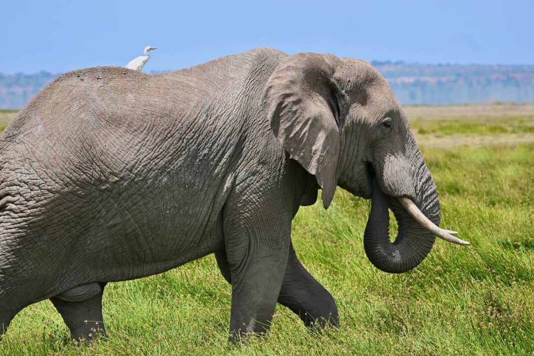
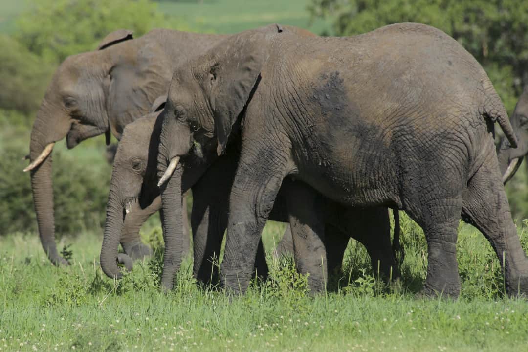
Nobody climbs Mount Kenya for the wildlife, but the mountain hands you a good deal of it anyway, and the lower forest is genuinely wild country. Elephant and buffalo live in the montane forest and the bamboo belt, and they are not a curiosity, they are the reason armed rangers sometimes accompany parties on the wilder western approaches and why walking through bamboo in poor visibility is treated seriously. Buffalo in thick vegetation is the single most dangerous animal encounter on the mountain. Also in the forest you get black and white colobus swinging through the canopy, Sykes monkeys, bushbuck, duiker, giant forest hog, and the tracks and occasional sighting of leopard, which range surprisingly high.
Above the treeline the fauna thins out but becomes odder. Rock hyrax colonise the high camps and are shameless food thieves, capable of getting into a poorly closed pack in minutes. Groove toothed rats and mole rats work the tussock grass. Sunbirds, particularly the malachite sunbird, feed on the flowering lobelias and are the most reliably beautiful thing you will see above 4,000 metres. Mackinder's eagle owl, a high altitude form of the Cape eagle owl found here, hunts the moorland at dusk. Augur buzzards ride the valley thermals, and on a still afternoon in the Teleki or Mackinder valleys the loudest sound is often a bird rather than anything else.
The plants are the real spectacle and they deserve more attention than most trekkers give them. The giant lobelias and giant groundsels of the afro alpine zone exist almost nowhere else on earth, having evolved separately on each of East Africa's high mountains to survive a climate that freezes every night and bakes every day. The groundsels grow a thick collar of dead leaves around their trunks for insulation. The lobelias fold their rosettes closed at night and hold a slush of fluid in the centre that protects the growing tip from freezing. Walking through a stand of them in mist, with the tussock grass silvered by frost, is the most otherworldly hour on the whole mountain, and it is worth stopping to actually look rather than putting your head down and grinding out the altitude.
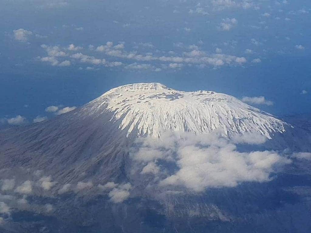
Higher again you reach the glaciers, and this is the part of Mount Kenya that is disappearing in front of us. The mountain sits almost exactly on the equator and still carries permanent ice, which is remarkable in itself. Lewis Glacier, the largest and the one you walk beside on the way to Point Lenana, has lost the overwhelming majority of its mass within living memory, and old photographs taken from the same spot are genuinely shocking to compare with what is there now. Tyndall, Darwin, Gregory and the others are following. The famous ice routes on the south face, the Diamond Couloir above all, were among the finest ice climbs in the world and are now unreliable or effectively gone. The equatorial glaciers here are widely expected to disappear within the next couple of decades, and the guides who have worked this mountain for thirty years will point at bare rock and tell you where the ice was when they started.
Sirimon route: the acclimatisation choice
Sirimon approaches from the northwest out of Nanyuki and is the route most experienced operators recommend for a first ascent of Point Lenana. It has two things going for it. First, it sits in the drier rain shadow side of the mountain, so you get less bog, less mud and more settled weather than the eastern approaches. Second, and more importantly, it gains height gradually and its camp spacing suits acclimatisation, running from the gate up through forest and moorland to Old Moses at around 3,300 metres, then a long day across the moorland into the Mackinder Valley to Shipton's Camp at roughly 4,200 metres. From Shipton's it is a straightforward summit push to Point Lenana. The scenery on the moorland traverse is broad and open rather than dramatic, which is the one criticism, but you are far more likely to reach the summit feeling reasonable on Sirimon than on anything else, and that is what most people should be optimising for.
Naromoru route: fastest, steepest, and the vertical bog
Naromoru comes up the west side and is the shortest and steepest way to Point Lenana, which is precisely why it is popular with operators selling three day trips and precisely why so many of those trips fail. It runs from the roadhead to the Met Station at about 3,050 metres, then climbs hard onto the moorland and into the Teleki Valley to Mackinder's Camp at roughly 4,200 metres. Between those two lies the section everybody warns you about: the Vertical Bog, a steep, saturated stretch of moorland where in the wet months you sink to the ankle or worse with every step and the whole thing takes hours. Naromoru gains altitude fast enough that acute mountain sickness is common on it, and the summit failure rate reflects that. Use it as a descent, where the speed is an advantage and the bog is at least downhill, and only use it as an ascent if you are already well acclimatised or genuinely short of days.
Chogoria route: the most beautiful by a distance
If somebody asks which route is the most spectacular, the answer is Chogoria and it is not a close call. Coming up the eastern side from Chogoria town, you drive or walk through some of the finest montane forest on the mountain, then emerge onto moorland above the Nithi Falls with the whole eastern face opening up. From the camp at Minto's Hut near the Hall Tarns, around 4,300 metres, you stand at the lip of the Gorges Valley, a vast glacial trench, with Lake Michaelson lying in a bowl several hundred metres below you beneath the cliffs of the Temple. It is the single best view on Mount Kenya and one of the best in East Africa. The catch is that Chogoria sits on the wet side and can be muddy and cloud bound, and the walk in through the forest is long. Nobody who has the days should skip it. If you only get one Chogoria day, make sure it is the one that includes Lake Michaelson and the Gorges Valley.
The Sirimon up, Chogoria down traverse
This is the recommendation for anyone with five days or more, and it is what a good operator will steer you towards without being asked. You ascend on the dry northern side where the gradual profile lets you acclimatise properly, cross the mountain via Point Lenana at dawn, and descend the eastern side past Simba Col to Minto's Hut, then out through the Gorges Valley and the Chogoria forest. You get the best of both flanks, you never repeat a step, and you walk through every vegetation belt on two different aspects of the mountain. It costs a little more in logistics because your vehicle has to reposition from Nanyuki round to the eastern side, which takes several hours by road, and that is the only real argument against it. A Sirimon to Chogoria traverse over five or six days is the best trekking week Mount Kenya offers, and it is what most people wish they had booked once they hear about it on the mountain.
Timau route: the quiet northern approach
Timau comes in from the north and is the least used of the named routes, to the point that many operators do not offer it at all. It crosses the driest and barest ground on the mountain, with sparse vegetation and long open views out over the northern plains, and you can go for a whole day without seeing another party. Historically a rough track allowed vehicles some way up this side, which shortened the walk considerably, though conditions on it vary and it should never be assumed. Timau is not a beginner's route in the sense that support, camps and rescue are all thinner here than on Sirimon, and it works best for parties who are self sufficient, already acclimatised, or specifically after solitude. If your priority is to be alone on the mountain rather than to maximise your chances on the summit, this is the side to ask about.
Burguret and the wild western approaches
Burguret is the route for people who want the mountain rough. It climbs the western flank through dense forest and a long bamboo belt with barely a path in places, involves genuine route finding, and passes through country where elephant and buffalo are regularly encountered, which is why parties on it often travel with an armed ranger. There are no huts, so you camp the whole way. It is slow, wet, physically awkward and unusually rewarding, and it delivers the closest thing to genuine wilderness trekking available on Mount Kenya. Kamweti, on the southern side, is similarly overgrown and even less used. Neither should be a first ascent of the mountain, and neither should be attempted with an operator who has not personally worked it. If you have already done Sirimon or Chogoria and want to come back to a mountain you thought you knew, this is how.
Summit night to Point Lenana
Whichever route you take, the last section is broadly the same experience. You leave camp at two or three in the morning by headtorch, into hard frost and usually a clear sky, and climb steadily on scree, frozen ground and broken rock. From Shipton's it is a long ascent to Simba Col and up. From Mackinder's it runs past the Austrian Hut at around 4,790 metres, close under the remains of the Lewis Glacier. The final approach to the summit is a rocky scramble with real exposure in places, and in icy conditions parties sometimes rope the last section, so an ice axe and crampons may be sensible depending on the month. You arrive around sunrise, which is the whole point: Batian and Nelion catch the first light directly above you, and on a clear morning Kilimanjaro floats above the cloud far to the south. It is cold enough at the top that most people last fifteen minutes.
Batian and Nelion: the mountaineers' peaks
These are the real summits and they are a different sport. Nelion is normally climbed by the Normal Route on its southeast face, a long day of sustained rock climbing, generally started from a bivouac at the base and often finishing with a night in the tiny Howell Hut on Nelion's summit. Batian is then reached by descending into the Gate of the Mists, the notch between the two peaks, which can hold snow and ice, and climbing back out the other side. Everything is harder than the technical grade suggests because you are at five thousand metres, the rock is often freezing, weather closes in from mid morning and a rescue is a serious undertaking. You need genuine multi pitch rock experience, your own competent partner or a qualified mountain guide, and full acclimatisation before you start. The best conditions are in the two dry seasons, particularly January and February. This is not something to attempt as a step up from a Point Lenana trek.
Mountain
Mount Kenya
Take it with you
Everything on this page in one document you can keep, print, or send to whoever you are travelling with. No email required.
Batian at 5,199 metres and Nelion at 5,188 metres are the true twin summits of Mount Kenya, and both are technical rock peaks. Reaching either means multi pitch rock climbing with ropes and hardware at around five thousand metres, and crossing between them means descending into and climbing out of the Gate of the Mists, which frequently holds ice. Point Lenana at 4,985 metres is a separate, lower summit on the same massif and is reached by walking and scrambling with no technical climbing required. Essentially every commercial trip advertised as climbing Mount Kenya goes to Point Lenana. That is not a lesser objective, it is simply a different one, and the confusion matters because people occasionally book a trek believing they will stand on the highest point of the mountain. They will not, and no reputable operator will pretend otherwise.
No technical climbing skill is required. If you can walk uphill for six or seven hours a day on rough ground, you have the ability to reach Point Lenana. What you do need is a head for a bit of exposure, because the final approach involves scrambling on rock with drops beside it, and reasonable balance on scree and frozen ground in the dark. In colder months there can be ice on the last section and parties sometimes use a rope, crampons and an axe, so ask your operator what conditions are expected in your month and whether that kit is included. The real barrier to Point Lenana is not skill, it is altitude and cold. Fit young people fail on this mountain every week because they went up too fast, and slower, older, better acclimatised parties walk past them.
For a first ascent with five or more days, go up Sirimon and down Chogoria. Sirimon is on the drier northern side and its gradient and camp spacing give you the best acclimatisation profile, so you arrive at the summit push in decent shape. Chogoria is the most beautiful part of the mountain by a wide margin, taking you past Lake Michaelson and along the rim of the Gorges Valley, and it is far better walked downhill in daylight than ground out uphill. Naromoru is the fastest and steepest, includes the notorious Vertical Bog, and produces a high rate of altitude sickness when used as an ascent, so treat it as a descent option or a route for people already acclimatised. Timau and Burguret are for solitude and for repeat visitors rather than for first timers.
Four days is the practical minimum and it is tight. Five is the sensible standard, and six is where the mountain becomes enjoyable rather than a race, particularly if you want the Chogoria descent with time to walk down into Lake Michaelson rather than merely looking at it. The three day trips advertised on the Naromoru route are the equivalent of the shortest Kilimanjaro itineraries: they exist, some people succeed on them, and the failure and illness rates are high enough that no experienced guide would recommend one. Every extra night below 4,300 metres buys you a meaningful improvement in your chances. If your budget is fixed, spend it on an extra day rather than on better equipment.
Common, and the discipline required is the same as on Kilimanjaro. Point Lenana is just under five thousand metres, and mild headaches, poor appetite, broken sleep and breathlessness affect a large share of trekkers. The defences are unglamorous and effective: choose an itinerary with a gradual profile, walk far more slowly than feels natural, drink steadily through the day, eat even when you do not want to, and take an acclimatisation walk in the afternoon to a higher point before sleeping lower. Some people use preventative medication and that is a conversation to have with a doctor before you travel rather than with your guide on the mountain. The rule that matters most is the one people ignore: if symptoms are getting worse rather than better, the only reliable treatment is to descend, and descending is quick on this mountain.
It is one of the best preparations available, and a lot of people plan the two together for exactly that reason. A four or five day trek to Point Lenana takes you to within a few hundred metres of the altitude of Kilimanjaro's Barafu camp and gives your body a genuine exposure to sleeping above 4,000 metres, which is worth far more than any amount of gym work. It also lets you test your boots, sleeping bag, layering and appetite at altitude before you commit to the bigger and more expensive mountain. Allow a gap of several days to a week between them, use it to travel south and rest properly, and do not treat Mount Kenya as a warm up you can rush. The acclimatisation benefit fades over a couple of weeks, so booking them months apart gives you the experience but not the physiological head start.
Colder than most people expect from a mountain on the equator. The ground above the moorland freezes every night of the year, and summit night with wind can be well below freezing while you are moving slowly in the dark. Assume a proper four season sleeping bag, an insulated mat, a down jacket, waterproof shell and trousers, warm hat and liner gloves plus heavier gloves, and a headtorch with spare batteries that you keep warm in your bag overnight. Broken in waterproof boots and gaiters matter more here than on Kilimanjaro because of the bog, and a change of dry socks each day is not a luxury. Bring sun protection too, because equatorial ultraviolet at 4,500 metres is brutal even when the air is cold. Most operators rent the bulky items in Nanyuki or Nairobi, but check what condition the rental gear is actually in.
Yes, if you are already a competent rock climber. Nelion is usually climbed by the Normal Route on the southeast face, a long day of sustained multi pitch climbing that most parties start from a bivouac at the foot of the face and often break with a night in the small Howell Hut on Nelion's summit. Batian is then gained by descending into the Gate of the Mists and climbing the far side, a section that regularly holds snow and ice. Nothing about it is casual: the altitude drains you, the rock is frequently cold enough to numb your hands, weather usually closes in from mid morning, and evacuation from high on the face is slow and difficult. You need solid trad and multi pitch experience, either a qualified mountain guide or a partner you would trust anywhere, and full acclimatisation beforehand, typically earned by trekking to Point Lenana first. January and February are the most settled months for it.
Mount Kenya sees a small fraction of Kilimanjaro's traffic, and that difference is much of the appeal. There are days on Chogoria and Timau when you will see no other party at all, and even the popular camps like Shipton's and Mackinder's feel like small mountain huts rather than tented villages. The busiest moment of a typical trip is sunrise on Point Lenana in peak season, when a few dozen people might be on the summit at once, which is still an order of magnitude quieter than the equivalent morning on Kilimanjaro. As for guides, you should treat one as essential. Park regulations and practice require you to go with a registered guide, the forest below the park holds elephant and buffalo, route finding above the moorland is not trivial in cloud, and porters make the difference between a hard trek and a miserable one.