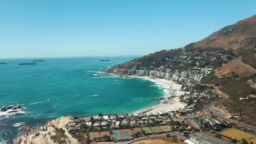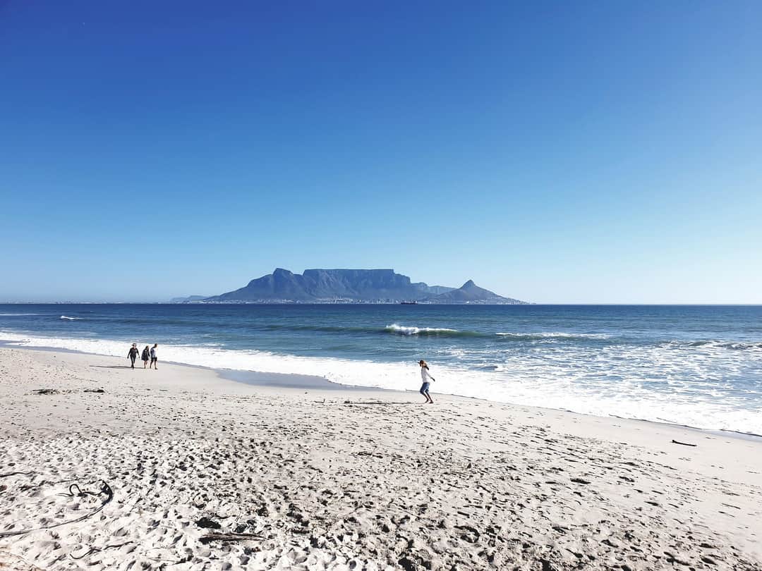
Mountain in South Africa
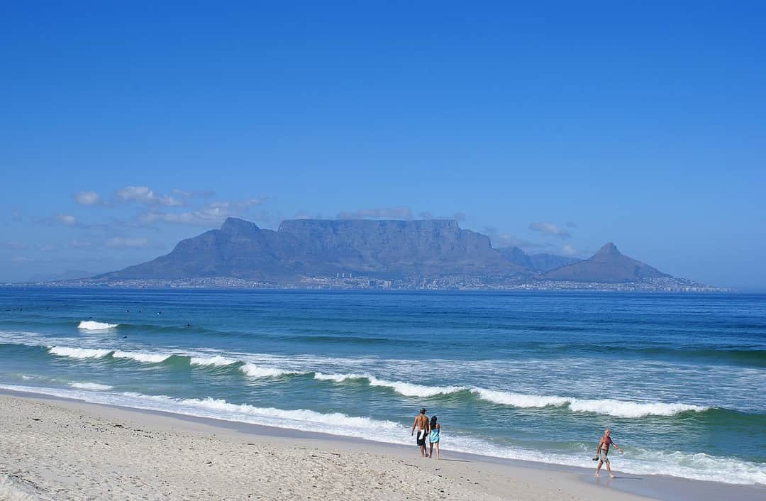
Table Mountain is the flat topped block of sandstone that Cape Town is built against, rising to 1,086 metres at Maclear's Beacon and ending on its city side in a cliff face that runs unbroken for about three kilometres. From the streets below it looks like a wall. From the top it turns out to be something else entirely: a broad, undulating plateau of rock and low scrub called the back table, with reservoirs, streams, footpaths and its own weather, stretching south towards the Twelve Apostles.
What makes it unusual is not the height. It is the immediacy. You can leave a hotel breakfast in the city bowl and be standing on a genuine mountain summit within two and a half hours on foot, with no transfer, no trailhead drive of any length and no permit. That accessibility is the mountain's great gift and it is also the thing that gets people into trouble, because a mountain you can see from a restaurant table does not feel like a mountain that needs planning.
It does. The weather here changes faster than most visitors have experienced anywhere. The southeast wind pushes moist air up the back of the mountain, where it condenses into the flat white cloud locals call the tablecloth, and it can pour over the front edge and swallow the summit in twenty minutes. Trails that were obvious become invisible. Temperature at the top can be ten degrees below the city, and wind on an exposed edge does the rest. Mountain rescue teams are called out here regularly, and the pattern is nearly always the same: somebody set off late, in shorts, with a phone for a map and no jacket, on a clear afternoon that did not stay clear.
The other thing worth knowing before choosing a route is that there is no single walk up Table Mountain. There are dozens of lines up it, and they differ enormously. Platteklip Gorge is a relentless staircase with no route finding and no exposure. India Venster is a scramble with chains, drops and real consequences. Skeleton Gorge climbs through forest on wooden ladders from a botanical garden. They share a summit and almost nothing else, and choosing wrongly is the most common mistake people make here.
There is also a cable car, and no one should feel bad about using it. It rises to the western end of the table in about five minutes, the floor rotates so everyone gets the view, and the top station puts you onto easy level paths with a cafe. Many people walk up and ride down, which is a good arrangement for knees. Just do not assume it will be running.
Best time to visit
The mountain's seasons are Cape Town's seasons, but the consequences up here are sharper.
Summer, from December to March, gives you long dry days and the highest chance of a clear summit, but it also brings the southeaster. When it blows hard, and it can blow hard for several days in a row, the cableway shuts and the exposed routes become genuinely unpleasant or unsafe. Summer is also hot, and Platteklip Gorge faces north into full sun with essentially no shade, which turns a two hour walk into an ordeal by eleven in the morning. If you are walking up in summer, start at first light.
Winter, from June to August, is wetter and cooler, with cold fronts arriving every few days. Between fronts you get some of the clearest, stillest air of the year and the mountain is green with water running in the gorges. The catch is that wet sandstone is slick, and the scrambling routes, India Venster above all, should be left alone in the rain. Skeleton Gorge's ladders and streambed also become treacherous. Winter has fewer people and better light, and the cableway is less often closed by wind, though it does close for its annual maintenance period, usually a couple of weeks around the end of July, so check before you plan a trip around it.
The shoulders are the answer if you can pick. February to April and October to November give you the best combination of settled weather, tolerable temperatures and less wind, and April in particular is close to perfect for walking here.
Whatever the season, the time of day matters more than the month. Early morning is calmest, coolest and clearest, and the wind typically builds through the afternoon. Sunset from the top is spectacular, but if you are up there for it you need a torch, warm layers and a firm plan for getting down, whether that is the last cable car or a headlamp descent of Platteklip.
High season
The cableway is busiest from mid-December to mid-January and again through the European summer from June to August, with the worst queues late morning and again in the hour before sunset. On a clear day in early January the wait at the lower station can be substantial. The walking routes never get crowded in the same way, though Platteklip and Lion's Head both see steady traffic at weekends and on full moon evenings.
The mountain's headline is botanical rather than zoological. Table Mountain is part of the Cape Floral Region World Heritage Site, and the fynbos growing on it includes an extraordinary number of species found nowhere else, many of them confined to this one mountain. Proteas, ericas and restios dominate, and up close what looks from the road like grey scrub resolves into an intricate mess of flowers, most of them small and most of them worth stopping for. King proteas flower in the cooler months, and in midsummer the red disa, the mountain's own orchid and an emblem of the Cape, appears on the wet rock beside streams on the back table. Fire is part of this system rather than a failure of it, and burnt slopes flower spectacularly in the seasons afterwards.
The animal you will certainly meet is the dassie, or rock hyrax, a stout grey creature the size of a rabbit that basks on the rocks around the upper cable station and is entirely unbothered by people. Its closest living relatives are elephants, which is the kind of fact that sounds invented and is not. Do not feed them, tempting as it is.
Birds are the other real presence. Orange-breasted sunbirds and Cape sugarbirds work the protea heads, their long tails trailing, and both are Cape endemics. Verreaux's eagles, black with white wing markings, hunt along the cliffs and are often seen from the front face routes. Rock kestrels, red-winged starlings around the upper station, and a handful of raptors riding the updraught along the edge complete most days' list.
Larger mammals exist but are seldom seen. Caracal live on the mountain and prey on the dassies, porcupines leave quills on the paths, and Cape grysbok move through the thicker fynbos at dawn and dusk. Chacma baboons range across the peninsula further south, around Cape Point and Simon's Town rather than the mountain proper, and there they are bold enough to be a genuine nuisance. Do not carry visible food in baboon country and never hand anything over.
The Aerial Cableway
Five minutes from the lower station on Tafelberg Road to the western end of the table, in a car whose floor rotates through a full turn so nobody is stuck facing the rock. At the top there are paved level paths, viewpoints over the city bowl, Camps Bay and out along the peninsula, and a cafe. It is genuinely worth doing even if you plan to walk, and walking up then riding down is the arrangement most people are happiest with. Buy online to skip the ticket queue. What you cannot buy is weather: the cableway closes in high wind, usually at short notice, and it takes an annual maintenance break of a couple of weeks in mid-winter. Check its status the morning you intend to go and treat it as a first-clear-day plan rather than a fixed appointment.
Platteklip Gorge
The direct route and the one most people should take. It starts from Tafelberg Road about twenty minutes' walk beyond the lower cableway station and goes straight up the cleft in the front face, which from below looks like a crack and turns out to be a staircase of stone steps that simply does not stop. It is the hardest easy walk in Cape Town. There is no scrambling, no exposure and no route finding, so you cannot really get lost, but it climbs roughly seven hundred metres in around two to three hours and it is punishing in heat. The gorge faces north and holds the sun, and there is no water on it. Start at dawn, take at least two litres a person, and expect the last third to be slower than the first. At the top you come out on the plateau about fifteen minutes' walk from the upper cable station.
India Venster
The most scenic way up the front face and the one that gets people hurt. It leaves from near the lower cableway station and traverses under and across the face, with sections of genuine scrambling on rock, chains and metal staples bolted in for the harder moves, and drops beneath you that are real. It is a scramble, not a hike, and people have died on it, most of them having wandered onto it in trainers assuming it was another path up. Do not attempt it in wet or windy conditions, do not do it in mist, and do not do it if you are unsure about exposure or if you are alone. If you have a head for heights and dry weather it is the best two and a half hours on the mountain, with the cable cars passing overhead and the city directly below your boots. If in any doubt at all, go and enjoy Platteklip instead. Going down it is a bad idea in any conditions.
Skeleton Gorge from Kirstenbosch
The back way, and completely different in character. It starts inside Kirstenbosch Botanical Garden on the eastern slopes and climbs through cool indigenous forest along a streambed, up a series of wooden ladders and boulder steps, into the shade the whole way. It emerges onto the back table near the reservoirs, and from there you can cross the plateau to Maclear's Beacon, the mountain's true summit, and continue to the cable station. It is longer than Platteklip, around four to five hours to the top station, and much more varied. The streambed becomes slippery and occasionally dangerous after rain, so avoid it in wet weather. The classic circuit is up Skeleton and down Nursery Ravine back into the garden, which makes a fine day without needing the cableway at all.
Kasteelspoort and the Twelve Apostles
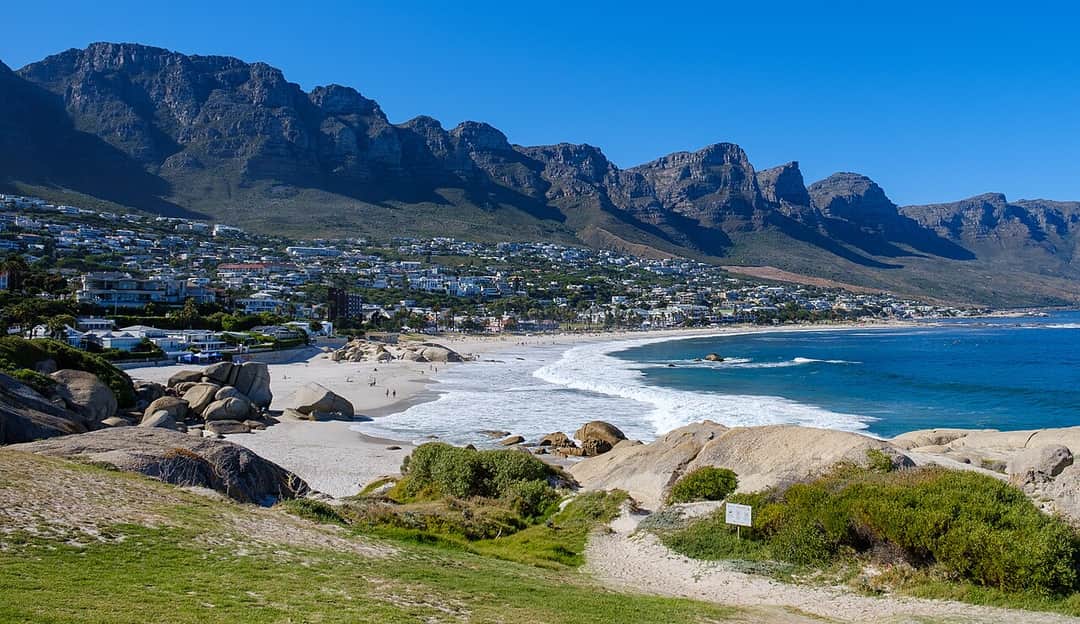
The quiet route, starting from the Pipe Track above Camps Bay and climbing a ravine between the buttresses of the Twelve Apostles onto the western end of the back table. It is a proper walk of around three hours with steady views out over the Atlantic rather than the city, and you will meet a fraction of the people you would on Platteklip. Near the top it passes the ruined station of the old cableway that once served the reservoirs, and the flat rock outcrop nearby, widely photographed as the diving board, juts out over an enormous drop. Take it seriously: it is unfenced and the wind up there is unpredictable. From the top you can walk east across the plateau to the upper cable station or return the way you came.
Lion's Head
Not Table Mountain at all but the conical peak beside it, and the best alternative in the city when the mountain is closed or you want something shorter. A spiral path winds around the cone with the view changing from city to sea to mountain as you go, and near the top there is a short section of chains and metal staples on rock, with a signposted easier bypass for anyone who would rather not. It takes most people an hour to an hour and a half. It is the classic sunset walk, and on full moon evenings the path fills with locals coming up in the dusk and down by torchlight. If you do that, bring a torch of your own and warm layers, and be aware the descent in the dark is where people turn ankles. Signal Hill next door is drivable if you want the view with no walk.
The back table and Maclear's Beacon
Most visitors ride up, take photographs from the paved viewpoints within two hundred metres of the upper station, and go back down. That is a shame, because the mountain proper starts where the paving stops. Maclear's Beacon, the highest point at 1,086 metres, is a marked walk of roughly forty five minutes each way from the upper station across the plateau, and it takes you out of the crowd almost immediately into rock, fynbos and silence. Longer paths run south across the back table past the reservoirs and down towards Kirstenbosch or Constantia Nek. Take a paper map or a downloaded offline one, because paths cross frequently up there and mist makes them hard to follow, and give yourself a firm turnaround time so you are not navigating the plateau in cloud.
Mountain
Table Mountain
Take it with you
Everything on this page in one document you can keep, print, or send to whoever you are travelling with. No email required.
Platteklip Gorge, the standard route, takes most reasonably fit people two to three hours from Tafelberg Road to the plateau, plus fifteen minutes to reach the upper cable station. India Venster is similar in time, around two to three hours, but the effort is different because of the scrambling. Skeleton Gorge from Kirstenbosch is longer, four to five hours to reach the cableway across the back table. Add time for heat, for photographs and for the fact that almost everybody underestimates Platteklip. If you are walking down rather than taking the cable car, allow around two hours for the descent and expect your knees to notice.
For most visitors, Platteklip Gorge. It is unambiguous, needs no navigation and no head for heights, and it gets you to the top by the shortest line. It is hard work but it is hard work of a very simple kind. If you want the best walk rather than the simplest, and the weather is dry and still and you are comfortable with exposure, take India Venster. If you would rather be in shade and forest and are happy with a longer day, take Skeleton Gorge from Kirstenbosch. If you want quiet and ocean views, take Kasteelspoort. And if you only have an hour and a half, Lion's Head gives you eighty per cent of the view for a fraction of the effort.
Yes, and it is the most popular arrangement. One way tickets are sold at the upper station, so you do not need to buy anything before you set off. It saves your knees the descent, which on Platteklip is genuinely more punishing than the climb for a lot of people. The risk is that the cableway stops running for wind while you are on the mountain, which happens often enough to plan around. Before you commit to walking up with no intention of walking down, check the wind forecast, and be honest with yourself about whether you could descend Platteklip on tired legs if you had to. Carry a torch in case that descent takes longer than expected.
It deserves respect rather than fear, and the risks are specific rather than general. The first is weather: cloud can cover the summit in minutes, visibility drops to a few metres, and people who were following an obvious path find themselves navigating rock in cold wet air. The second is route choice, particularly walkers who drift onto India Venster or one of the scrambling lines without realising what they have taken on. The third is exposure and cold, because the plateau is much colder and windier than the city below it. The mitigations are unglamorous and effective. Start early. Take a windproof layer and more water than you think. Tell someone your route. Do not descend by an unfamiliar route in fading light. Turn back if the cloud comes in rather than pushing on. Cell reception is generally good on the mountain and mountain rescue in Cape Town is excellent, but the aim is not to need them.
Not for Platteklip, Lion's Head or Skeleton Gorge, which are well used and well marked, though for Skeleton Gorge a downloaded offline map is worth having for the plateau crossing afterwards. A guide is a genuinely good idea on India Venster if you are unsure about scrambling, and on any of the less travelled routes across the back table, where paths braid and mist is a real risk. There is a second reason people hire guides here that has nothing to do with navigation: walking in a group of one or two on a quiet trail is when the occasional robberies have happened, and a guided group removes that concern along with the route finding.
For Platteklip, fit enough to climb stairs continuously for two hours or more. That is the honest description: it is a staircase of seven hundred vertical metres with no flat sections to recover on. If you walk regularly and can manage hills, you will be fine, though you will be slow and hot. If you do not, the cableway exists and there is no shame in it. Lion's Head is a much gentler proposition and suits most people with normal mobility. Skeleton Gorge is longer but the gradient is kinder and it is shaded. India Venster asks for upper body confidence and a head for heights more than for endurance.
Wind, almost always. The cars run on cables strung across an exposed face and the operators suspend service well before conditions become genuinely marginal, which is the correct call and not an inconvenience worth arguing with. The southeaster that blows through the summer months is the usual cause, and it can shut the service for two or three consecutive days. There is also a scheduled maintenance closure once a year, usually a couple of weeks around the end of July. The practical response to all of this is to keep the mountain flexible in your itinerary. Check the operator's status page in the morning, go on the first still, clear day of your trip, and have Lion's Head or Signal Hill as a fallback.
More water than feels necessary, at least two litres a person on a warm day, because there is none on the front face routes and the stream water on the back table is not something to rely on. A windproof and preferably waterproof layer, even on a hot clear morning, because the summit is a different climate. Proper shoes with grip, not smooth soled trainers. Sun protection, since Platteklip has no shade at all. Also take a torch or headlamp if there is any chance of being late, a phone with an offline map downloaded rather than one relying on a signal, and enough food to keep you going. Leave nothing visible in your car at the trailhead.
It is an excellent one, and plenty of people who do both prefer it. It is much shorter, around an hour to an hour and a half, the spiral path gives you a constantly changing panorama rather than one fixed view, and from the summit you look across at Table Mountain itself, which you obviously cannot do from Table Mountain. It is the standard sunset walk in Cape Town and it is busy at that hour, particularly around full moon. If you go for sunset, take a torch, take a warm layer, and remember that the chained section is harder coming down in the dark than it was going up in daylight. There is a marked bypass around the chains for anyone who would rather avoid them.